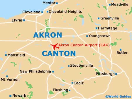
Akron Canton Regional Airport (CAK)
Orientation and Maps
(Canton, Ohio (OH), USA)
Standing in the state of Ohio, Canton is located in Stark County and was officially founded at the beginning of the 19th century. With a population of more than 80,000 and a number of attractions, many people visit the city of Canton each year. Highlights here include the McKinley National Memorial Park and also the extremely popular Pro Football Hall of Fame.
In the northwestern region of the city you will find the busy Akron Canton Regional Airport (CAK), off the Vietnam Veterans Memorial Highway and in the Green area. The airport is also conveniently close to the city of Akron and Cleveland.
Akron Canton Airport (CAK) Maps: Important City Districts
Canton is divided into ten main districts, all of which have something appealing to offer. The main districts include Crystal Park, Harter Heights, Highland Park, the Newton Zone, Ridgewood and Summit.
There are many prominent landmarks around the city of Canton, such as Meyers Lake to the west of the city center, close to Malone College, Havard Park and several golf courses. To the northeast, Pleasant View and Harmont Park are easy to reach, being sited off the Atlantic Boulevard NE.
Further afield and just a short drive from Canton, Massillon is located directly west, Louisville to the northeast, and New Philadelphia to the south.
USA Map

Ohio Map

Canton Map